# 简单示例
# 在html中使用
<!DOCTYPE html>
<html lang="en">
<head>
    <meta charset="UTF-8">
    <meta http-equiv="X-UA-Compatible" content="IE=edge">
    <meta name="viewport" content="width=device-width, initial-scale=1.0">
    <title>基础地图展示</title>
    <link href="ol.css" type="text/css">
    <script src="ol.js"></script>
    <style>
        html,body{
            width: 100%;
            height: 100%;
            padding: 0px;
            margin: 0px;
            box-sizing: border-box;
        }
        #mapBox{
            width: 100vw;
            height: 100vh;
            background-color: antiquewhite;
        }
    </style>
</head>
<body>
    <div id="mapBox"></div>
    <script>
        const map=new ol.Map({
            target:"mapBox",
            layers:[
                new ol.layer.Tile({source:new ol.source.OSM()})
            ],
            view:new ol.View({
                projection:"EPSG:4326", // 默认3857
                // center: ol.proj.fromLonLat([120.13989, 30.27662]), // 转为3857
                center:[120.13989, 30.27662],
                zoom: 11,
                minZoom:10,
                maxZoom:13
            })
        })
    </script>
</body>
</html>
# 在Vue中使用
//安装
npm install ol

//使用
<template>
    <div id="content">
        <div id="map" class="map"></div>
    </div>
</template>

<script>
import "ol/ol.css"
import { Map, View } from "ol"
import { defaults as defaultControls } from "ol/control"
import Tile from "ol/layer/Tile"
import XYZ from "ol/source/XYZ"
import Projection from "ol/proj/Projection"
import { fromLonLat, transform, addProjection } from "ol/proj"

export default {
    name: "tree",
    data() {
        return {
            map: null
        }
    },
    mounted() {
        this.initMap()
    },
    methods: {
      initMap() {
        let target = "map"
		let tileLayer = [
			new Tile({
			  source: new XYZ({
				// 天地图矢量经纬度投影
				url: "http://t3.tianditu.com/DataServer?T=vec_c&x={x}&y={y}&l={z}&tk=KEY",
				projection: 'EPSG:4326'
			  }),
			}),
			new Tile({
			  source: new XYZ({
				// 天地图矢量经纬度注记
				url: "http://t3.tianditu.com/DataServer?T=cva_c&x={x}&y={y}&l={z}&tk=KEY",
				projection: 'EPSG:4326'
			  }),
			}),
			new Tile({
			  source: new XYZ({
				// 天地图影像经纬度投影
				url: "http://t3.tianditu.com/DataServer?T=img_c&x={x}&y={y}&l={z}&tk=KEY",
				projection: 'EPSG:4326'
			  }),
			}),
			new Tile({
			  source: new XYZ({
				// 天地图影像经纬度注记
				url: "http://t3.tianditu.com/DataServer?T=cva_c&x={x}&y={y}&l={z}&tk=KEY",
				projection: 'EPSG:4326'
			  }),
			}),
			new Tile({
			  source: new XYZ({
				// 天地图矢量墨卡托投影
				url: "http://t3.tianditu.com/DataServer?T=vec_w&x={x}&y={y}&l={z}&tk=KEY",
				projection: 'EPSG:3857'
			  }),
			}),
			new Tile({
			  source: new XYZ({
				// 天地图矢量墨卡托注记
				url: "http://t3.tianditu.com/DataServer?T=cva_w&x={x}&y={y}&l={z}&tk=KEY",
				projection: 'EPSG:3857'
			  }),
			}),
			new Tile({
			  source: new XYZ({
				// 天地图影像墨卡托投影
				url: "http://t3.tianditu.com/DataServer?T=img_w&x={x}&y={y}&l={z}&tk=KEY",
				projection: 'EPSG:3857'
			  }),
			}),
			new Tile({
			  source: new XYZ({
				// 天地图影像墨卡托注记
				url: "http://t3.tianditu.com/DataServer?T=cva_w&x={x}&y={y}&l={z}&tk=KEY",
				projection: 'EPSG:3857'
			  }),
			})
		]
		// 设置4326投影,默认3857
		let projection = new Projection({
			code: 'EPSG:4326',
			units: 'degrees',
			extent: [-180, -90, 180, 90],
			global: true
		})
		addProjection(projection)

		let view = new View({
			center: [118.653678, 36.411430],
			// center: fromLonLat([118.653678, 36.411430]), // 3857
			zoom: 10,
			minZoom: 7,
			projection: projection // 不加默认为3857
		})
		this.map = new Map({
			target: target,
			layers: tileLayer,
			view: view
		})
      }
    }
};
</script>
注意: mounted调初始化方法 地图不显示,浏览器窗口变化地图开始渲染
// 这样不行
this.$nextTick(() => {
    this.initMap()
})
// 这样可以
setTimeout(() => {
	this.initMap()
}, 100);
# 加载WMS服务
import Tile from "ol/layer/Tile"
import TileWMS from 'ol/source/TileWMS'
import { fromLonLat, transform, get as getProjection } from "ol/proj"

// VERSION也可以是 1.3.0,取决于你的 GeoServer 配置
// STYLES设置显示的样式
let params = { LAYERS: 'gather:pts', VERSION: '1.1.1', STYLES: 'point', CQL_FILTER: '1=1'}
const wmsLayer = new Tile({
	name: 'plotmap',
	source: new TileWMS({
		url: '/wfs/geoserver/gather/wms',
		params: params,
		serverType: 'geoserver' // 有好几种地理服务器,要明确指定
	})
})
this.map.addLayer(wmsLayer)

// 点击元素的信息
this.map.on('click', evt=> {
	// const size = this.map.getSize()
	// const bbox = this.map.getView().calculateExtent(size)
	const viewResolution = this.map.getView().getResolution()
	const projection = this.map.getView().getProjection() //getProjection('EPSG:4326')
	//const coordinate = transform(evt.coordinate, 'EPSG:3857', 'EPSG:4326')
	const url = wmsLayer.getSource().getFeatureInfoUrl(evt.coordinate,
	                                                   viewResolution,
													   projection, {
	  'INFO_FORMAT': 'application/json','QUERY_LAYERS': 'gather:map_pts'
	})

	if (url) {
	  fetch(url)
		.then(response => response.json())
		.then(json => {
		  // 解析要素数量
		  const featureCount = json.features.length
		  console.log('Feature Count:', featureCount)
		})
		.catch(error => console.error('Error fetching features:', error))
	}
})
# 移除,重新添加geoserver图层不发生变化
openlayers提供了两个方法,一个是refresh()方法,对图层进行刷新重新加载,能够解决图层稳定在修改后,但如果地图没有移动缩放,还是会使用openlayers的wms缓存,一个是updateParams()方法,这个可以完美解决当前问题。
//通过修改STYLES属性,进而修改地图服务样式
import Map from 'ol/Map.js';
import View from 'ol/View.js';
import TileLayer from 'ol/layer/Tile.js';
import TileWMS from 'ol/source/TileWMS.js';

export default {
	name: "TestOL",
	data(){
		return{
			tileWMSSource:''
		}
	},
	mounted:function(){
		this.tileWMSSource = new TileWMS({
			url: 'http://localhost:8080/geoserver/wzf/wms',
			params: {
				'LAYERS': 'wzf:wafangdianshi_0',
				'TILED': true,
				'STYLES':'style1'// 设置初次显示时的样式
			},
			serverType: 'geoserver',
			projection: "EPSG:4326"
		});
		var tileLayer = new TileLayer({
			source: this.tileWMSSource,
		})

		var map = new Map({
			layers: [tileLayer],
			target: 'mapDiv',
			view: new View({
				center: [122, 40],
				zoom: 9,
				projection:"EPSG:4326"//默认的是 'EPSG:3857'横轴墨卡托投影
			})
		});
	},
	methods:{
		//点击按钮,切换地图样式(已经在Geroserver中存在的style,可以是sld或css)
		btnHandle:function(){
			this.tileWMSSource.updateParams({
				'STYLES':this.tileWMSSource.getParams().STYLES == 'CSS' ? 'style1':'style2'
			});
		}
	}
}
如果没有修改的参数,只是想重新请求加载geoserver,可以在加载图层的参数自定义一个参数time,存放时间戳,实现重新加载只需要updateParams()更新时间戳参数即可
let wmslayer:any;

//图层参数
const completeLayer = {
    id: 'completeLayer',
    url,
    opacity: 0.8,
    params: {
        ...completeClass,
        time: new Date().getTime(),
        viewparams: `areaCode:${331124015};areaLevel:${3};year:2021-2022`
    }
}

//添加图层
wmslayer = CMap.addWMSLayer(completeLayer);

//重新加载geoserver图层
wmslayer.getSource().updateParams({ "time": new Date().getTime() });
# 加载WFS服务
import 'ol/ol.css'
import Map from 'ol/Map'
import View from 'ol/View'
import { Vector as VectorLayer, Tile as TileLayer } from 'ol/layer'
import { Vector as VectorSource, OSM } from 'ol/source'
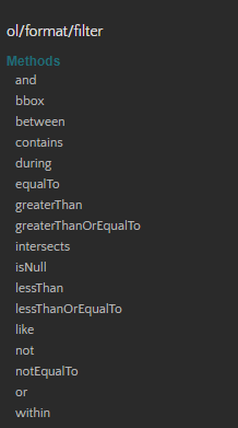
import { like, or } from 'ol/format/filter'
import { GeoJSON } from 'ol/format'
import { bbox } from 'ol/loadingstrategy'
import { Style, Stroke, Circle, Fill } from 'ol/style'
import { Projection } from 'ol/proj'
// 或者通过url加载
loader: function (extent, resolution, projection) {
var url = '/wfs/geoserver/gather/ows?service=WFS&version=1.0.0&request=GetFeature&typeName=gather:00&outputFormat=application/json'
fetch(url)
.then(response => response.json())
.then(json => {
var features = new GeoJSON().readFeatures(json, {
featureProjection: 'EPSG:3857' // 将数据投影到地图的投影
})
vectorSource.addFeatures(features)
}).catch(error => console.error('Error loading WFS data:', error))
},
strategy: bbox // 根据视图的 bbox 加载数据
})
// 或者
var featureRequest = new WFS().writeGetFeature({
srsName: 'EPSG:4326',// 坐标系
featureNS: 'www.qs99.cn',// 注意这个值必须为创建工作区时的命名空间URI
featurePrefix: 'gather',// 工作区的命名
featureTypes: [queryParams.mapType.split(':')[1]],// 所要访问的图层
maxFeatures: 5000,
outputFormat: 'application/json',
filter: ol.format.filter.like('NAME', 'lo*') // 属性过滤条件
})
fetch('/geoserver/gather/wfs', {
method: 'POST',
body: new XMLSerializer().serializeToString(featureRequest),
})
.then(function (response) {
return response.json()
})
.then(json => {
console.log(json)
const features = new GeoJSON().readFeatures(json)
vectorSource.addFeatures(features)
this.map.getView().fit(vectorSource.getExtent())
})
// 或者
let wfsVectorSource = new VectorSource({
format: new GeoJSON(),
projection: 'EPSG:4326',
declutter:true, // 文字标注重复显示解决办法
url: '/wfs/geoserver/gather/ows?service=WFS&version=1.0.0&request=GetFeature&typeName=gather:00&outputFormat=application/json',
strategy: bbox
});
var wfsVectorLayer = new VectorLayer({
name: 'gridmap',
source: vectorSource,
style: (feature) => {
const count = feature.get('count')
let color = `0,120,255,0.7` // 蓝色
if (count > 100) {
color = '200,0,120,0.7' // 紫色
} else if (count <= 100 && count > 50) {
color = '255,0,0,0.7' // 红色
} else if (count <= 50 && count > 10) {
color = '255,120,0,0.7' // 橙色
} else if (count <= 10 && count > 5) {
color = '0,180,0,0.7' // 绿色
}
color = `rgba(${color})`
return new Style({
fill: new Fill({
color: color,
}),
text: new Text({
text: count.toString(),
font: '12px Arial',
overflow: true, // 解决时显时没的问题
fill: new Fill({
color: '#000'
}),
// 创建wfs图层,注意需要设置好描边样式,否则不展示效果出来
stroke: new Stroke({
color: '#fff',
width: 3
})
})
})
},
zIndex: 3,
})
this.map.addLayer(geojsonLayer)
# WFS服务条件过滤
const vectorSource = new VectorSource();
const vector = new VectorLayer({
  source: vectorSource,
  style: new Style({
    stroke: new Stroke({
      color: 'rgba(0, 0, 255, 1.0)',
      width: 2,
    }),
  }),
});
this.map.addLayer(vector);
// 构建一个多边形
var polygon1=new Polygon([[
      [117.12499999999999, 31.00586290462421],
      [117.12499999999999, 32.091882620021806],
      [116.90551757812499, 32.091882620021806],
      [116.90551757812499, 31.00586290462421],
      [117.12499999999999, 31.00586290462421]]]);

// 需要将构建的面要素进行坐标转换,变成一个polygon要素
polygon1.applyTransform(getTransformss('EPSG:4326','EPSG:3857'));


// 空间过滤
const featureRequest = new WFS().writeGetFeature({
  srsName: 'EPSG:3857',
  featureNS: 'http://localhost/map',
  featurePrefix: 'osm',
  featureTypes: ['xxxxx'],
  outputFormat: 'application/json',

  filter:
  // equalToFilter('region', '澳门特别行政区')
  // andFilter(
  //   likeFilter('SCENEDATE', '2022/3/*'),
  //   equalToFilter('region', '安徽省')
  // ),
   ol.format.filter.intersects('the_geom',polygon1)
   // equalToFilter('SCENEDATE', '2013/5/21')
});

// 属性过滤
const filter1 = like('PID', queryParams.mapCode) // 定义过滤条件1
const filter2 = like('CODE', queryParams.mapCode) // 定义过滤条件2
const combinedFilter = or(filter1, filter2) // 使用ogc:And组合过滤条件

var featureRequest = new ol.format.WFS().writeGetFeature({
	srsName: 'EPSG:4326',// 坐标系
	featureNS: 'http://www.census.gov',// 注意这个值必须为创建工作区时的命名空间URI
	featurePrefix: 'tiger',// 工作区的命名
	featureTypes: ['poi'],// 所要访问的图层
	maxFeatures: 5000,
	outputFormat: 'application/json',
	// filter: ol.format.filter.like('NAME', 'lo*') // 单属性过滤条件
	filter: combinedFilter // 多属性过滤条件
});

var that = this.map
fetch('http://localhost:8080/geoserver/map/wfs', {
  method: 'POST',
  body: new XMLSerializer().serializeToString(featureRequest),
})
  .then(function (response) {
    return response.json()

  })
  .then(function (json) {
    const features = new GeoJSON().readFeatures(json);
    vectorSource.addFeatures(features);
    that.getView().fit(vectorSource.getExtent());
  });
在openlayers官网中,还有很多空间查询,基本上都大同小异
# 使用示例
项目示例一 (opens new window) 项目示例二 (opens new window) 项目示例三 (opens new window) 项目示例四 (opens new window)
# 地图缩放事件
// this.map.on('moveend', ()=>{                   // moveend 事件
this.map.getView().on('change:resolution', ()=>{  // change 事件
    if(this.mapName.includes('grid')){
        //第二个参数:是否是地图缩放事件
        this.loadWMSData(this.initParams, true)
    }
})
← 基础信息 OpenLayers3D →